Point Nepean National Park
Blog
 An Overview
Point Nepean National Park is located at the very tip of the Mornington Peninsula 110km, approx 1½ hours drive, south of Melbourne, Victoria, Australia.
Access
The park is open daily with vehicle access between 8am and 5pm and exit at any time. The Point Nepean Information Centre is open daily, except Christmas Day.
Cycling is permitted in parts of the park and bikes can be hired from the Information Centre. A hop on/off shuttle bus operates between 10.30am to 4.30pm and tickets can be purchased from the driver.
Self guided tour brochures and audio tours are available from the Information Centre or can be downloaded in advance at Parks Vic
A Brief History
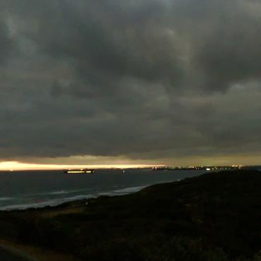
The area has played an important role in shaping the early settlement, quarantine and defence of Victoria and provides spectacular coastal scenery and views of Bass Strait, the Rip and Port Phillip Bay.
Port Nepean was a critical Part of Victoria’s defences from 1878 until 1948. After World War II soldiers were removed and the buildings and fortifications declared redundant. It was used as an occasional firing range and training ground, remaining closed to the public until 1988 when it was declared a national park.
Established in 1852 and closed in 1980, the quarantine station played a major role in quarantine for Victoria until 1979. In 1878 a cattle quarantine facility was established serviced by a jetty. Animal quarantine was later moved to Melbourne Zoo, Coode Island and Spotswood.
The Quarantine site later became home to the Army Cadet School (1952-1985), the School of Army Health (1985-1998) and in 1999 was used to accommodate Kosovo refugees. The Quarantine Station became part of the national park in 2009.
Dogs and other animals are not permitted.
Interesting information
- Point Nepean is part of Bunurong/Boon Wurrung country. The people of the Kulin nation lived on and around this land for over 35,000 years gathering shellfish and other foods along the coastline.
- Shepherd’s Hut, located in the Quarantine Station is one of the earliest intact limestone buildings in Victoria, its cellar dates back to 1845.
- Point Nepean Cemetery was established in 1854 replacing the Quarantine Station Cemetery after beach erosion unearthed burials. There are over 300 people buried in the cemetery. There are many unmarked graves of early settlers, quarantine and shipwreck victims and those posted to the area during its military use.
- Cheviot Hill was named after the shipwreck of the SS Cheviot on 19th October 1887. It became stranded on the coastal reef when its propeller broke. Tragically 35 passengers drowned.
- The first shot of World War 1 by the British Empire was fired at 12:45pm from Fort Nepean on 5th August 1914, 3 hrs and 45 mins after war was declared in London.
- The entrance to Port Phillip was the most heavily forted port in the Southern Hemisphere.
- Fort Nepean is considered to be one of the best examples in Australia of a major fort complex exhibiting the changes in military engineering over the 19th and 20th centuries.
- Monash Light was established in 1930 and named after Sir John Monash, commanding officer at Point Nepean 1897 to 1908. It was an important navigational feature for Port Phillip. The light has been extinguished but the tower is used as a relay transmission for tidal bouys.
- Harold Holt, the 17th Prime Minister of Australia went missing from Cheviot Beach whilst swimming, his body was never recovered and he was presumed drowned on 17th December 1967. A memorial is located above cheviot beach to mark the spot.
Flora and Fauna
- According to Parks Victoria the park is home to many native animals including White -footed Dunnart, Long nosed Bandicoot, Black Wallaby, Echidna, Singing Honeyeater and Hooded Plover. The park also comprises a large intact area of remnant coastal vegetation. Native plants and vegetation communities include Coastal Moonah Woodland, Coastal Dune Scrub, remnant grasslands and threatened orchids.
- Surrounding Point Nepean is Port Phillip Heads Marine National Park showcasing a great diversity and abundance of marine flora and fauna. Home for a variety of fish and shellfish, migratory shorebirds, marine invertebrates, dramatic underwater gorges, colourful sponge gardens, tall kelp forests and sea-grass beds.
Walking Tracks in Point Nepean National Park
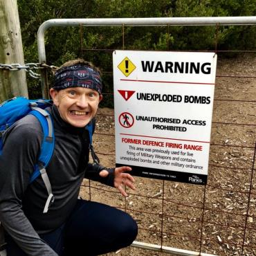
Due to its fragility and past use as a military site, access is restricted to specific areas. Observe warnings and stay on defined tracks.
Wilsons Folly Track
A 1.7km one way walk linking London Bridge in the Mornington Peninsula National Park with Point Nepean, passing pockets of coastal Banksia stands, Moonah woodland and native grasslands.
Bay Beach Walk
A 2.8km one way walk along the beach. Remnants of the former quarantine cattle jetty can be seen at Observatory Point.
Range Area Walk
A 1.8km one way walk that links the Quarantine Station and Cheviot Hill passing the former Rifle Range and through coastal scrub. It links to the Happy Valley Track and Monash Track providing access to the Monash Light Tower.
Walter Pisterman Heritage Walk
A 1km return walk starting near to the Gunners Cottage, passes Point Nepean Cemetery on the way to the bay.
Coles track
A 2.8km one way walk that links the Quarantine Station to Defence Road and Happy Valley Track. Established in the 1940’s for telegraph services, to improve communications between Melbourne and Fort Nepean during World War II.
Things to see and do in Point Nepean National Park
Quarantine Station
Explore the historical precinct with almost 50 heritage listed buildings and artefacts spanning over 150 years. A brochure and audio tour is available.
Cheviot Hill and Harold Holt Memorial
Cheviot Hill is the highest point of the park, overlooking Cheviot Beach and has World War II fortifications. The Harold Holt Memorial is located nearby on Defence Road.
Pearce Barracks, Fort Pearce and Eagles Nest
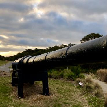
Explore the fortifications and look outs with stunning views of Bass Strait and Port Phillip. Pearce Barracks is where many of the army personnel stationed at Point Nepean lived. Fort Pearce was established in 1911 to take advantage of the 6” Mark VII guns being introduced to coastal defence at that time. And Eagles Nest was the site of Australia’s largest Disappearing Gun.
Fort Nepean
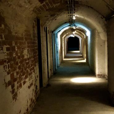
Discover a series of military fortifications dating back to the 1880’s, explore tunnels, forts and gun emplacements.
For more information about Point Nepean National Park see Parks Victoria
More Info:
Seagulls on the Run acknowledge the Traditional Owners of the land on which we work, live and play. We pay our respects to Elders past, present and emerging.
 An Overview


